Land use planning is a complex task. Many conflicting interests
must be reconciled in a rational, defensible and reproducible
fashion. Not only the land use allocation with respect to
its affinity must be valued, but also considering factors
such as the continuity between units and the compactness
of the created sets.
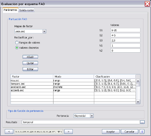
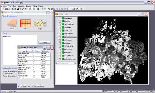
The Land Laboratory (LaboraTe) research group has developed
a software system for planning rural land use that will
guide the planner in the process. This system is innovative
because three basic stages of the planning process are incorporated
into a single tool that allows refining the outcome and
independently introduce improvements in each step: the assessment
of soil suitability for each use, optimization of areas
for each and the spatial location of the same. The aim of
OpenRULES (Rural Land-use Exploration System) is the automation
of the processes required to design land use plans, according
to the preferences and experience of the planner, so that
the system generates the optimal scenario of use soil to
specified conditions.
descargas: