Submitted by laborate on thu, 05/07/2012 - 10:19 GMT.
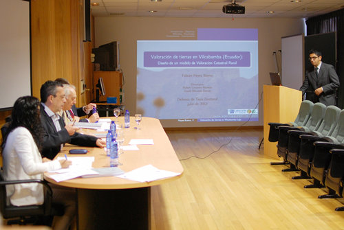
Fabián Reyes Bueno was granted a PhD degree after the public
defense of his dissertation "Land valuation in Vilcabamba
(Ecuador). Design of a rural cadastral valuation model.",
which took place in the Higher Polytechnic School of Lugo
last July, 2th.
The dissertation, written under supervision of Mr. Rafael
Crecente Maseda, PhD, and Mr. David Miranda Barrós, PhD,
analyzes the state of cadastral information in Ecuador,
and the perception of local residents about which factors
play a role in the value of land parcels. This perception
is then compared to empirical information taken from a sample
of parcels sold in the last years, and a number of statistical
methods are used to model land valuation, which allowed
the author to propose the use of classification and regression
trees (CARTS) as the most efficient alternative.
The PhD tribunal members were:
- PhD Domingo Gómez Orea, Departament of Land Planning, Urbanism and Environment, Polytechnic University of Madrid (Spain)
- PhD Edelmiro López Iglesias, Departament of Applied Economics, University of Santiago de Compostela (Spain)
- PhD María Amalia Velasco Martín-Varés, International Relations Coordinator, Spanish Directorate General for Cadastre
- PhD Manuel Gonzalo Alcázar Molina, Departament of Cartographic Engineering, University of Jaén (Spain)
- PhD Inés Santé Riveira, Departamente of Agricultural and Forestry Engineering, University of Santiago de Compostela (Spain)
This activity is part of a long standing collaboration between
the Land Laboratory of the University of Santiago de Compostela
and the Integrated Center of Environmental Geomatics
(CINFA) of the National University of Loja
(Ecuador). As part of the same joint effort, several CINFA
technicians have taken courses in the Master Programme in Sustainable Land Planning
of the USC. A more recent addition is the project
Ecuador Intelligent Territory
(Ecuidit), which has recently started.
downloads:
- presentation of the PhD tesis "Land valuation in Vilcabamba (Ecuador). Design of a rural cadastral valuation model." (in Spanish) [PDF; ~13.5 MB]